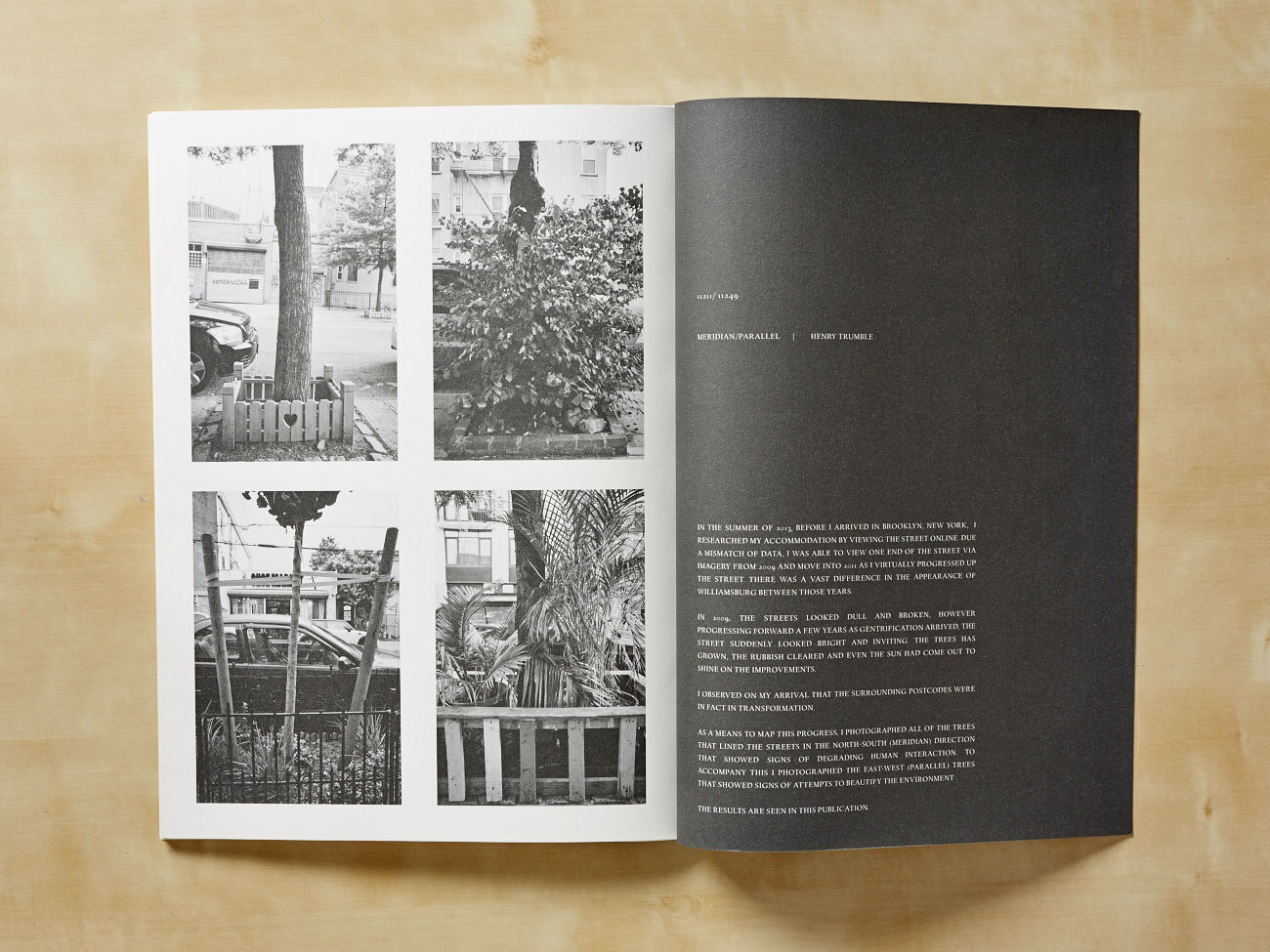

Meridian/Parallel
In 2013 before travelling to New York, I researched an area of Williamsburg online and found that as one progressed virtually along the street, Google Street View mixed current imagery with that of several years earlier.
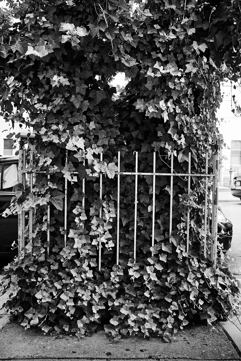
The transformation of the area was noticeable, the rubbish had been cleared and trees cared for. The imagery changed to describe a desirable view of the streets of Brooklyn.
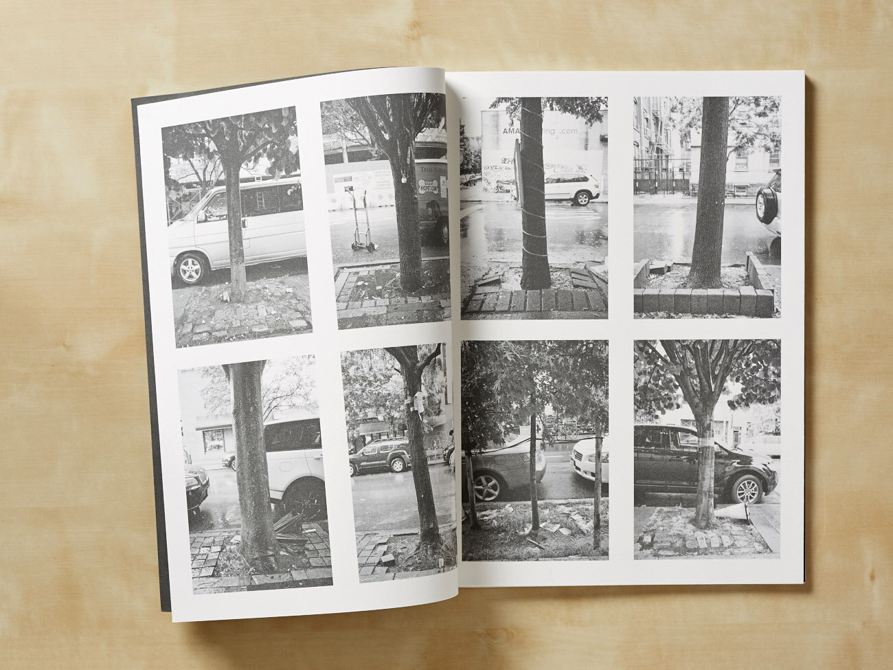
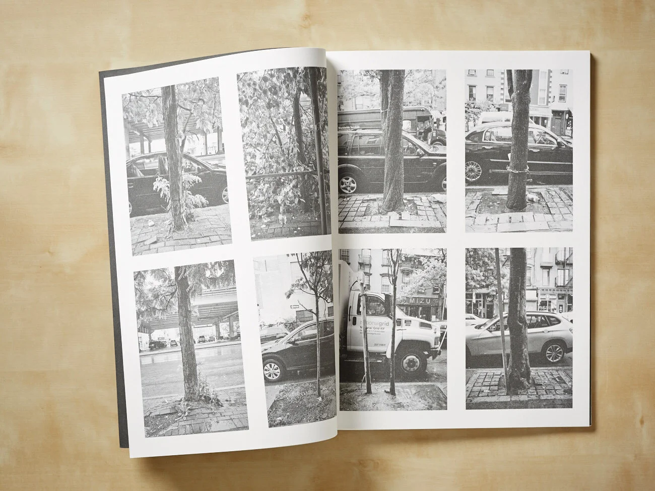
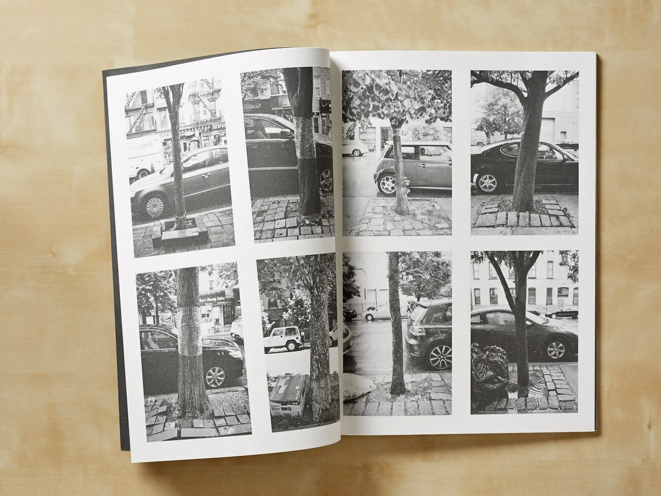
To record this change on my arrival in Williamsburg, I photographed every tree lining the north/south (Meridian) streets that showed the visible neglect of the older online imagery of the area. To contrast this I Followed along the east/west (Parallel) streets and photographed the trees that showed the care and investment the area had started showing.
The title for Meridian/Parallel comes from the work of photographer Timothy Henry O’Sullivan, who in the late 19th Century embarked on the Geological Exploration of the 40th Parallel and the 100th Meridian West. These geological surveys were made by order of the US Secretary of War, with the task to make the American West appear accessible and beautiful.
Meridian/Parallel is about a linear recording of the picturesque and the transformation of an urban area from a less desirable past. This process of gentrification, meaning a shift of an area or community to wealthier residents though the displacement of poorer people, is evident in many major cities of the world.